The NHC has identified another area in the southwestern Caribbean Sea as having the potential for development this week.

In the southwestern Atlantic Ocean, situated east of the Bahamas, an area of low pressure has emerged, and the National Hurricane Center (NHC) is closely monitoring its potential for development
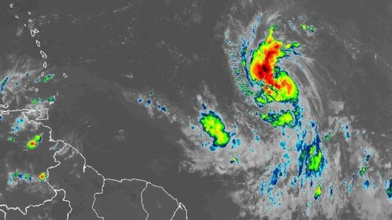
The FOX Forecast Center provides the latest updates on the systems being monitored in the Atlantic Basin. As of Sunday afternoon, data gathered from an Air Force reconnaissance aircraft revealed a broad area of low pressure a few hundred miles east of the central Bahamas. However, this system lacks a well-defined center of circulation.
This particular system has been labeled as Invest 96L by the National Hurricane Center (NHC), following their naming convention for systems under investigation for possible development. The National Hurricane Center (NHC) reports that environmental conditions are gradually becoming less favorable for development. Nonetheless, there remains a possibility of it forming into a brief tropical depression or tropical storm in the next day or so, as it tracks west-northwestward to northwestward. Should the system sustain winds of at least 39 mph, it will be designated as Tropical Storm Vince.
The National Hurricane Center (NHC) anticipates that strong upper-level winds and dry air will likely diminish the chances of further development as the system changes its course northward
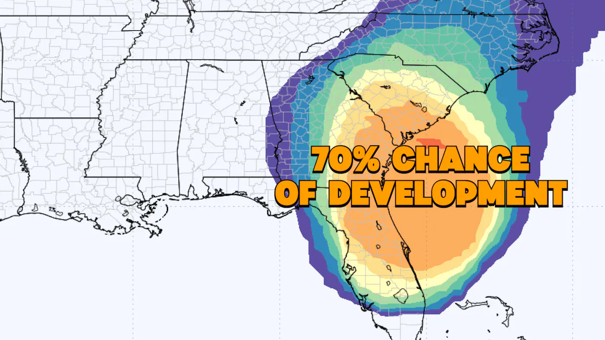
Meanwhile, there’s potential for the formation of a broad area of low pressure in the central or southwestern Caribbean Sea in the coming days. The National Hurricane Center (NHC) suggests that gradual development could occur as the system generally moves westward at speeds of 10 to 15 mph.
As of Sunday afternoon, the National Hurricane Center (NHC) assesses the likelihood of development for this system over the next seven days as relatively low. In separate news, after transitioning to a post-tropical cyclone last Thursday, Tammy briefly regained tropical storm characteristics on Friday. However, it swiftly reverted to a post-tropical cyclone early Sunday morning, positioned nearly 700 miles to the east of Bermuda.
The remnants of Tammy are projected to move east and then south, posing no further threats to Bermuda or other land areas. Notably, last Saturday, Tammy made landfall as a Category 1 hurricane with 85-mph winds on Barbuda in the northeastern Caribbean. Several of the northeastern Caribbean islands reported gusty winds, rough seas, and heavy rainfall as the core of the storm passed just miles to the east of many of those islands.
READ ALSO: Category 5 Hurricane Otis Leaves 39 Dead And Thousands Struggling In Mexico’s Aftermath