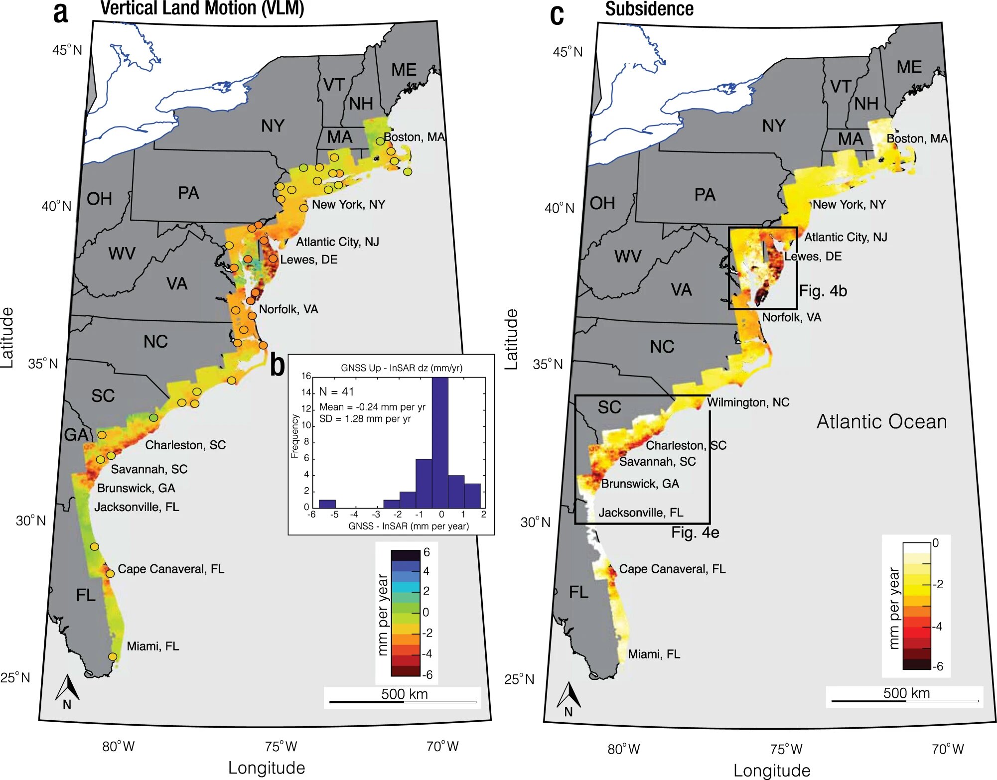
Observations from Satellite Data Reveal Subsidence along the US East Coast
Geologists using satellite data found that major Atlantic coast cities are subsiding 2 to 5 millimeters (.08-0.2 inches) every year. Satellite imagery shows faster subsidence than a year earlier. According to an article in the Proceedings of the National Academies of Sciences, community and infrastructure resilience planning is especially important for crucial elements including highways,…