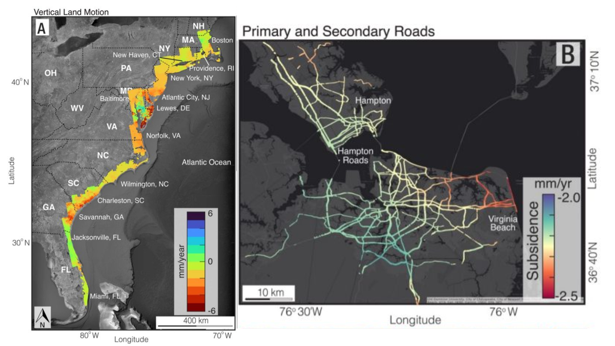
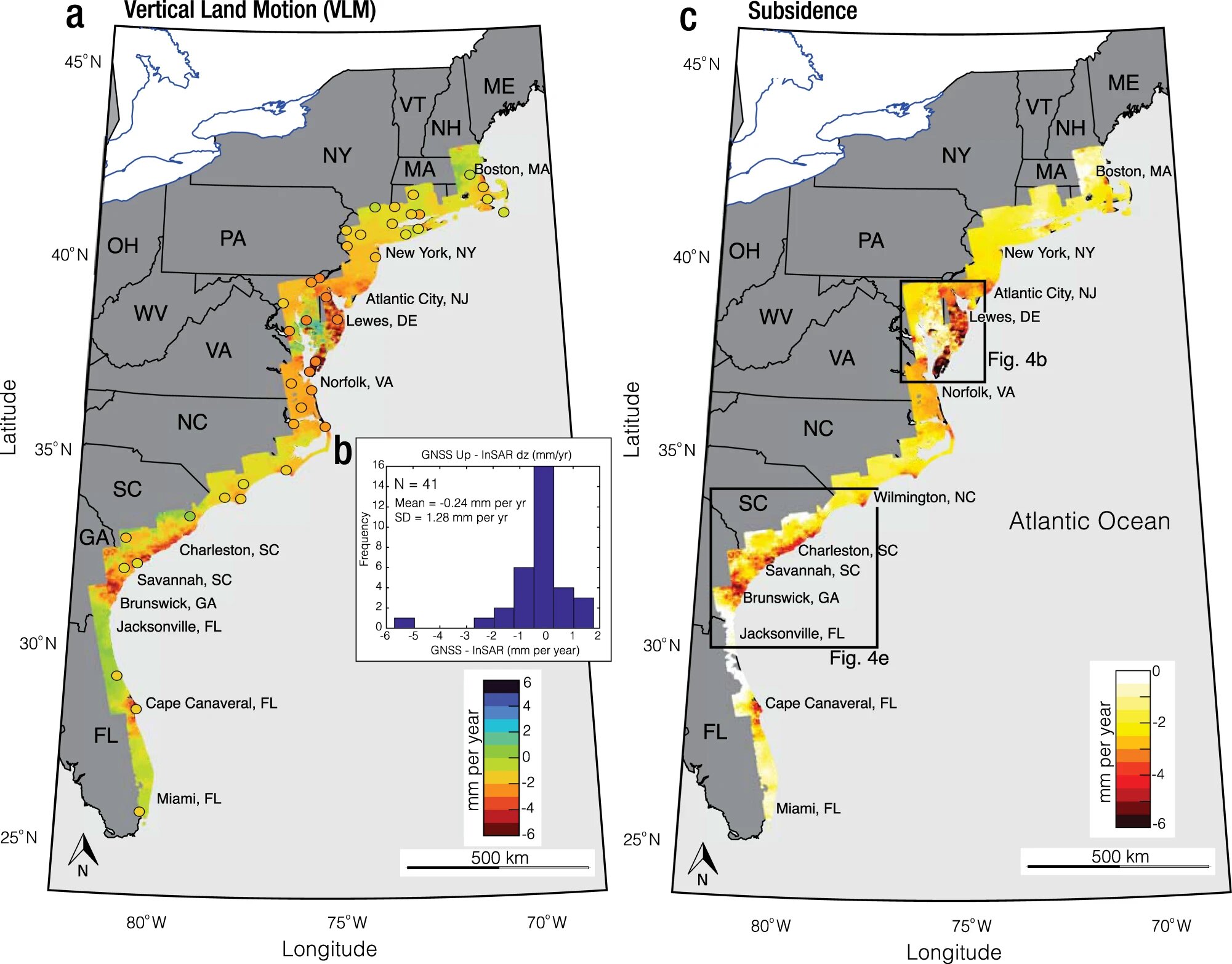
Geologists using satellite data found that major Atlantic coast cities are subsiding 2 to 5 millimeters (.08-0.2 inches) every year. Satellite imagery shows faster subsidence than a year earlier. According to an article in the Proceedings of the National Academies of Sciences, community and infrastructure resilience planning is especially important for crucial elements including highways, airport runways, building foundations, rail lines, and pipelines.

East Coast Cities Face Rising Vulnerability as Satellite Data Reveals Land Subsidence
Heavy-populated cities like New York City, Baltimore, Virginia Beach, and Norfolk are affected. Sinking ground makes these locations more vulnerable to weather and storm difficulties, compounding climate change-related storm intensification.
Lead author Leonard Ohenhen, a graduate student at Virginia Tech’s Earth Observation and Innovation Lab working with Associate Professor Manoochehr Shirzaei, lamented persistent East Coast subsidence. This is especially important in densely populated areas that have historically neglected infrastructure maintenance.
The Virginia Tech and USGS research team created computerized terrain maps using satellite photos and radar data to identify land subsidence risks to critical infrastructure. Many parts of the East Coast sink at least 2 mm (.08 inches) per year, and parts of the mid-Atlantic coast, spanning over 3,700 square kilometers (more than 1,400 square miles), sink more than 5 mm (0.2 inches). Global sea level increase, predicted at 4 millimeters per year, complicates the issue.
Growing Subsidence Threat to East Coast Cities and Infrastructure
The report, “Slowly but Surely: Exposure of Communities and Infrastructure to Subsidence on the US East Coast,” emphasizes sinking rates. It underlines that these subsidence rates affect a large land area, population, properties, and over 50% of infrastructure in major East Coast cities.
The issue affects population and infrastructure hubs as well as land sinking. Importantly, New York’s JFK and LaGuardia airports and runways, as well as train systems, face subsidence rates surpassing 2 mm per year, causing damage and flood threats.
Experts say the study’s technical expertise fills a vital gap in understanding and addressing subsidence on the U.S. East Coast.


